

Blackstairs Mountain [Na Staighri Dubha]
Good walks are even better shared.
S8144 : Crash Site
kevin higgins Photo source
Overview
Blackstairs Mountain [Na Staighri Dubha]
Nestled in the scenic Blackstairs Mountain range, Blackstairs Mountain stands proudly at an elevation of 702 meters. This Marilyn offers a wealth of stunning views and varied terrain, suitable for hikers of different skill levels.
Geology
Composed of colourful Old Red Sandstone, Blackstairs Mountain reveals a fascinating geological history. Its landscapes, shaped by natural forces, present striking contrasts that fascinate both the casual walker and the devoted geologist.
Routes
Whether you're after a gentle saunter or a more challenging loop, the Blackstairs have you well covered:
- The Mankeen Loop: This popular 9.5 km route is perfect for those wanting to experience the mountain's beauty without too much hard work. Estimated time: 3.5 hours.
- The Glencollogue Track: A more accessible option is this 6 km trail that takes you up the southern slopes. Designed for ease of access, hikers can enjoy the views while enjoying a straightforward ascent. Expect to spend about 2.5 hours here.
Summit Features
At the summit, adventurers will find a modest stone cairn marking the high point, surrounded by views that are simply breathtaking. Get your camera ready; this is one for the album!
Terrain Type
The terrain is an amiable blend of rocky pathways and grassy hillsides, with just enough boggy spots to keep things interesting. Remember, nobody likes a boring hike!
Views
One of the highlights of reaching these heights is undoubtedly the view. From the summit, you'll be treated to the sweeping vistas of the surrounding Blackstairs, the Barrow Valley, and even a glimpse of the Wicklow Mountains to the north. To catch the beauty in its prime, plan your trip in spring or early autumn when colours pop and skies are clear.
Hazards
While the mountain is welcoming, caution is key. Weather can change quicker than a student dodging homework, so be prepared! After a rain, trails can become slick, reminding hikers to tread carefully.
Nearby Summits
Don't stop your adventures here! Nearby is Mount Leinster, the tallest in the range, and Cullen Hill, both worth a visit for their own delightful offerings.
Access
Eager to get started? The Mankeen Car Park is your best bet for parking. For those relying on public transport, walking from Enniscorthy will sure get the blood pumping!
Facilities
Facilities are relatively sparse, but you can find portable toilets at the car park. Fancy a bite? Head to Borris for some local treats.
History
The mountain’s name, Na Staighri Dubha, tells a tale of its own, translating to 'Black Stairs', hinting at those steep climbs we all love to conquer. Historically, this area has rich folklore, making it a special spot for both hiking and storytelling.
In conclusion, Blackstairs Mountain is more than just a workout; it's a journey through stunning landscapes and history, ready to welcome hikers of all stripes!
Explore routes near Blackstairs Mountain [Na Staighri Dubha]
Walks starting near this hill. Open a route to check its map, distance and full itinerary.
Route planning notes
These notes describe possible approaches. Check a route's map and access information when planning your walk.
The Mankeen Loop
A popular route starting from the Mankeen car park that loops around the mountain, including views of the surrounding valleys.
The Glencollogue Track
A straightforward trail that meanders up the southern slopes, providing a gentle ascent and rewarding views at the summit.
Make a day of it, together
Find someone to share the walk with, or organise a day out along a route you like.
Photo Gallery
View all Photo could not load
S8144 : Crash Site
kevin higgins
 Photo could not load
S8144 : Summit Cairn
kevin higgins
 Photo could not load
S8144 : Summit Cairn
kevin higgins
 Photo could not load
S8144 : Blackstairs Summit
kevin higgins
Hill facts and local notes
Classifications
Elevation
732m
2,402 ft
Prominence
537m
Coordinates
52.5489, -6.8057
S810447
OS Map
68
At the Summit
The summit is crowned with a small stone cairn and offers a fine panorama of the surrounding landscape. On a clear day, you're likely to spot the Irish Sea!
Terrain & Geology
The Blackstairs are primarily composed of Old Red Sandstone, providing a colourful patchwork of hues ranging from deep reds to vibrant ochres. The erosion of this rock type has created distinct ridges and valleys, offering a striking landscape for hikers and geology enthusiasts alike.
Views & Scenery
From the summit, you can see the ancient Blackstairs hills extending towards the east, as well as the majestic Barrow Valley and even the Wicklow Mountains to the north.
History & Heritage
Name Origin
The name 'Na Staighri Dubha' translates to 'Black Stairs', a fitting title considering its steep ascents and rugged terrain.
Historical Significance
Blackstairs Mountain has been a popular location for both hiking and historical folklore, with layers of ancient tales embedded in its slopes.
Getting There & Facilities
Parking
The Mankeen Car Park provides ample space for vehicles and is located a short distance from the starting point of the common trails.
Public Transport
The nearest train station is in Enniscorthy, approximately 18 km away. Local buses may operate, but a car is recommended for convenience.
Nearby Facilities
Temporarily available toilets can be found near the car park. For cafes or dining, venture to Borris for a cuppa and a scone.
Safety Information
Known Hazards
- Watch out for sudden weather changes; conditions can shift from sunshine to shower in the blink of an eye. The terrain can also be slippery after rain.
General Safety Tips
- Check weather conditions before setting out
- Carry appropriate clothing and equipment
- Let someone know your planned route
- Take a map, compass, and GPS device
- Carry emergency supplies: food, water, first aid kit, torch
Hills
Some common questions about the hills answered
Are there group walks up Blackstairs Mountain [Na Staighri Dubha]?
Many walkers use Walkmates to join or organise walks with others. You can check for group walks around Blackstairs Mountain [Na Staighri Dubha] through the maps
Are there other walkers around Blackstairs Mountain [Na Staighri Dubha]?
Activity varies by location and time, but Walkmates lets you see whether others have shared walks or shown interest in this area. Find other people through the walking friends search walking friends for Blackstairs Mountain [Na Staighri Dubha] search or of course create your own walk for Blackstairs Mountain [Na Staighri Dubha]
Can I organise a walk to Blackstairs Mountain [Na Staighri Dubha]?
Yes. If there aren’t any walks listed already, you can create a walk and make it available for others to join.
If you're signed up to Walkmates, you can create a walk to Blackstairs Mountain [Na Staighri Dubha].
How do I find a walk up this hill?
There are often multiple ways to walk this hill, depending on experience and route preference. Walkmates helps you explore walks and routes that others have shared.
Can I suggest a new route up Blackstairs Mountain [Na Staighri Dubha]?
Yes. You can suggest or create routes to share with others. Walkmates focuses on the social side of walking, so routes are used to help people organise walks and explore areas together, rather than as detailed navigation tools or route libraries.
Other uses really appreciate knowledgeable walkers sharing their routes. Share your favourite route to Blackstairs Mountain [Na Staighri Dubha] here
The is an error or something incorrect about this hill. How do I let you know?
We always strive to keep the information on Walkmates as accurate as possible. If you find an error, please let us know through the contact form and we'll aim to correct it as quickly as possible
Community Discussion
Comments
Location
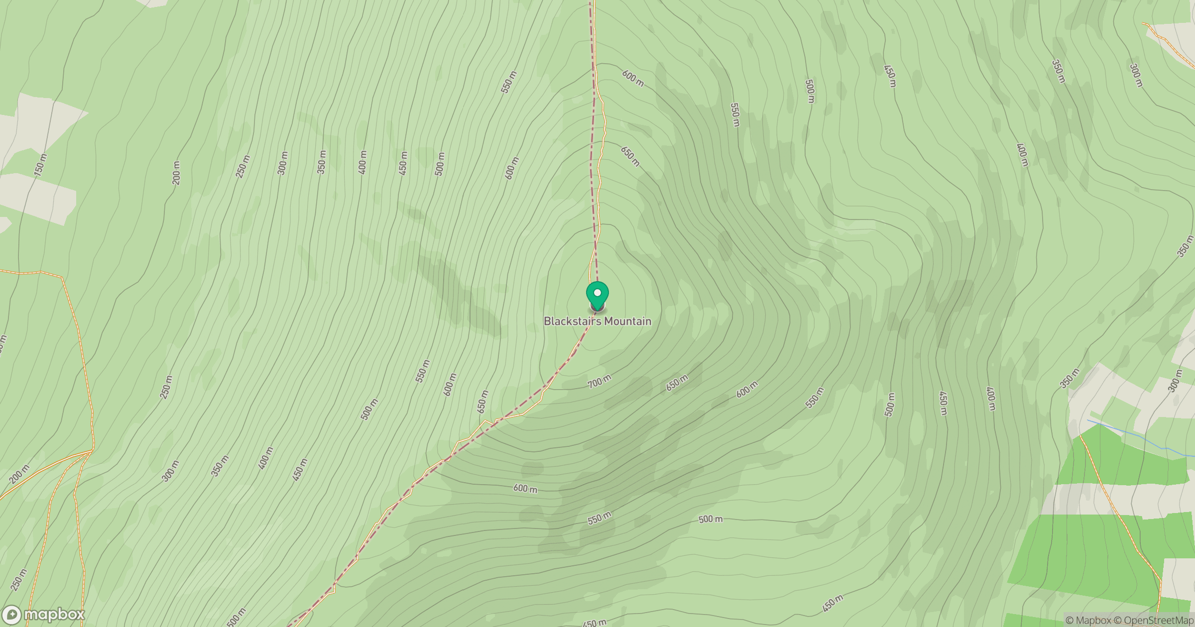
Grid reference: S810447
View on OpenStreetMapOpens a map in a new tab, centred on the hill.
No comments yet. Be the first.